
Louisiana loses roughly a football field of coastal wetland every 100 minutes. That is the average rate the U.S. Geological Survey measured for 2010 to 2016. Stretch it back further and the state has lost about 2,000 square miles of land since 1932, an area the size of Delaware, around a quarter of what was there. Here is what is actually driving it, and what it looks like from the seat of a kayak.
The number, said correctly
You hear a lot of versions of this stat, and some of them are wrong, so let me be precise, because being precise is the point. The USGS figure is a football field every 100 minutes, averaged over 2010 to 2016. You will sometimes hear “every hour” or “every 30 minutes,” and fact-checkers have pushed back on those. The honest picture is actually a little hopeful: the current rate is roughly a third of what it was at the peak in the late 1970s, when Louisiana was losing a football field closer to every 34 minutes. The slowdown is partly real restoration work and partly just the luck of not taking a major hurricane hit for a stretch.
None of which changes the headline. The state is still shrinking, measurably, every single day.
Why it’s happening
The short version: we broke the system that built this land in the first place. The Mississippi River spent thousands of years flooding and dumping sediment across its delta, and that sediment is what the swamps and marshes are made of. Then we leveed the river to stop it flooding towns, which also stopped it feeding the wetlands. The sediment now shoots straight off the end of the river into deep Gulf water instead of spreading out to build land.
On top of that, thousands of miles of canals were cut through the marsh for oil and gas access and navigation. Those canals let saltwater push inland, and saltwater kills freshwater cypress and marsh grass. The ground itself is also sinking, a process called subsidence, and the sea is rising to meet it. Put it together and you get land that is starved of new sediment, poisoned with salt, sinking, and drowning all at once.
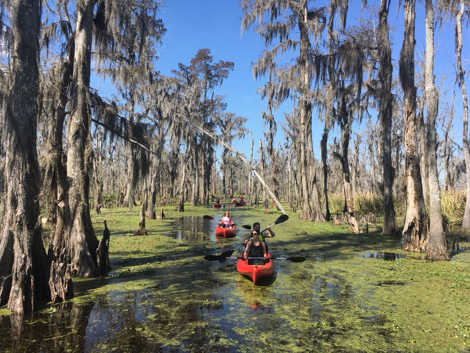
What it looks like from a kayak
This is the part you can actually see, and it is why I think paddling here matters. Out in the brackish zones you find ghost forests, stands of cypress that are already dead, gray and bare, killed by saltwater that crept in years ago. They stand there in open water that used to be marsh. You will paddle past trees that are essentially headstones for the landscape that used to hold them up.
You also see the good stuff, which is the other reason to go: the marsh that is still thriving, the wading birds, the gators, the cypress that is still healthy further from the salt. Seeing both in one trip is what makes the loss real in a way that a statistic never will.
Can it be stopped?
Slowed, probably. Reversed, in places, maybe. Louisiana has spent serious money on coastal restoration, the headline projects are sediment diversions that intentionally cut the river levee to let the Mississippi build land again, the way it used to. They are controversial, expensive, and slow, and they will not save everything. But the land-loss rate has come down from its peak, and some restored marsh is genuinely holding. I would not call it optimism exactly. Call it that the fight is not over.
The small part that low-impact tourism plays: kayaks don’t churn the bottom or throw wake the way airboats and motorboats do, and an economy built on people wanting to see a living swamp gives that swamp a reason to keep existing. That is the bet behind eco-tourism here. It is not going to save the coast on its own, but it beats the alternative.
If you want to see it firsthand, the cypress swamps around Manchac and Honey Island are the most accessible places to start, and our tour comparison covers the operators who run low-impact kayak trips.
Common questions
How fast is Louisiana losing land?
According to the U.S. Geological Survey, Louisiana lost coastal wetland at an average rate of about one football field every 100 minutes between 2010 and 2016. Since 1932 the state has lost roughly 2,000 square miles, about the size of Delaware.
Why are Louisiana’s swamps and wetlands disappearing?
The main causes are levees on the Mississippi River that cut off the sediment that built the wetlands, canals cut through the marsh that let in saltwater, land subsidence, and sea level rise. Together they starve, poison, and sink the wetlands.
What is a ghost forest?
A ghost forest is a stand of dead trees, often cypress, killed by saltwater intruding into what was once freshwater swamp or marsh. The bare gray trunks are left standing in open water and are one of the most visible signs of wetland loss in Louisiana.
Are Louisiana’s swamps going to disappear completely?
Not entirely, and the rate of loss has slowed to about a third of its 1970s peak. Coastal restoration projects, including sediment diversions that rebuild land with river mud, are working to slow and locally reverse the loss, though they cannot save all of it.
See a living swamp while it’s still here.
Leave a Reply