Category: Swamp Stories

Folklore, ghost towns, ecology, and the wild history of the swamps around New Orleans.

  • Is It Safe to Kayak With Alligators?

    Is It Safe to Kayak With Alligators?

    Kayakers paddling past a still stretch of the Manchac Swamp in Louisiana

    Louisiana has more than three million wild alligators. Verified fatal alligator attacks in the state over the past century: fewer than two. Those two numbers together are the honest answer to whether it is safe to kayak with alligators. The risk exists. It is also genuinely very small, and most of what makes it small is not luck.

    What the numbers actually say

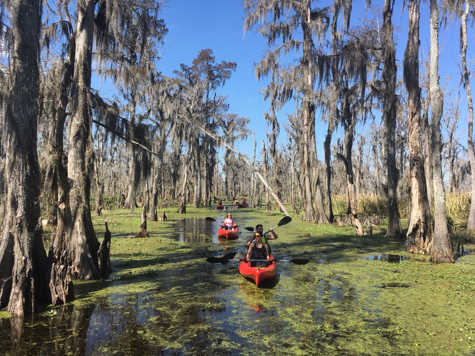
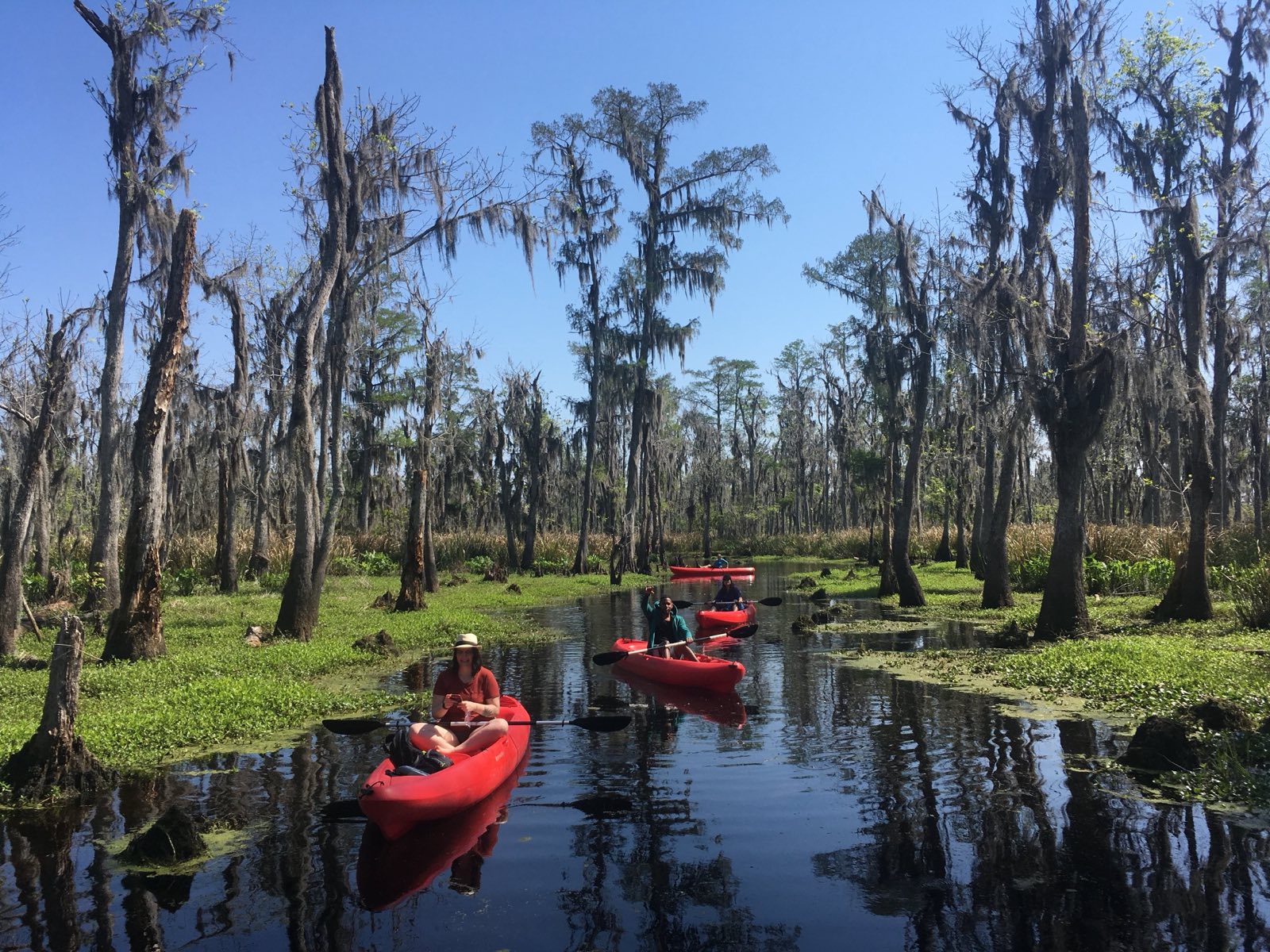
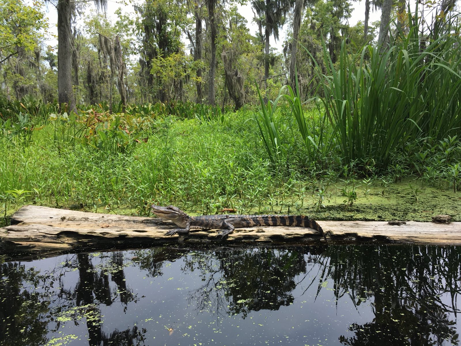
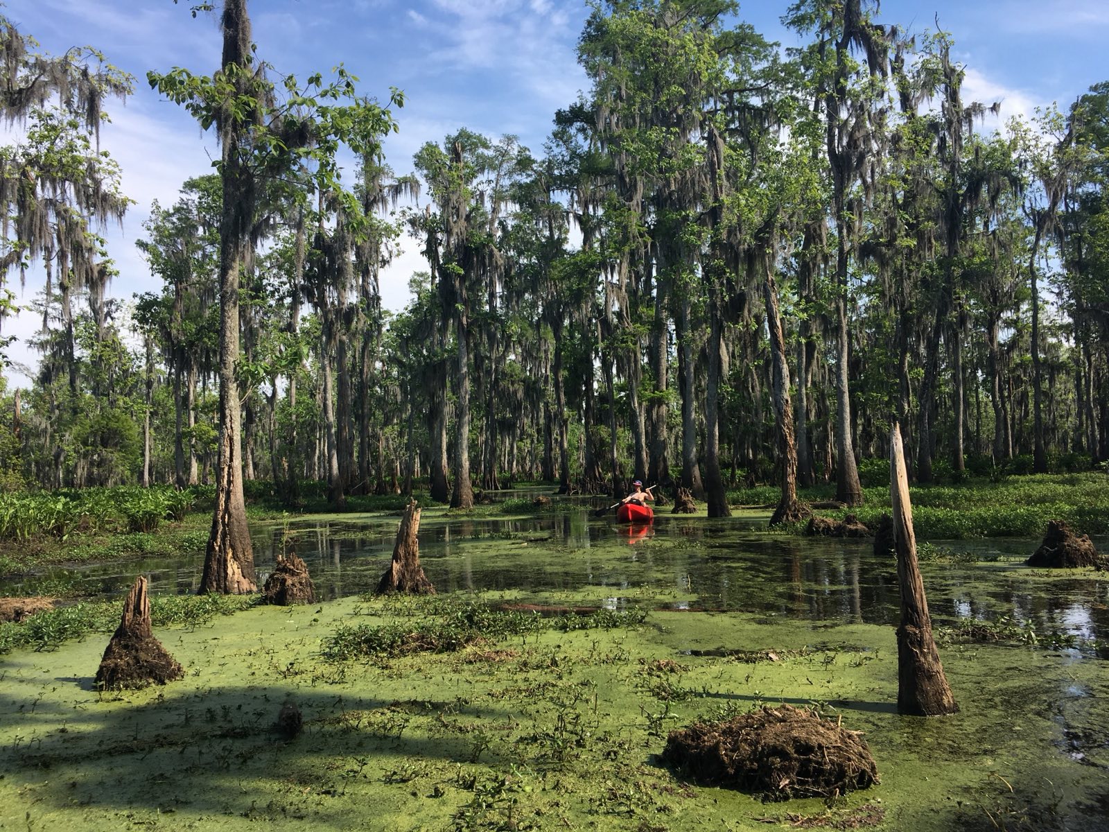
    Alligators are ambush predators that target things at the water’s surface, usually at dusk and dawn when visibility drops. A kayak is larger than any prey they are used to, louder than anything in their normal experience, and smells like a human, which they have learned to avoid. The combination means that most alligator encounters from a kayak end with the gator sliding off its log before you even get close. They are avoiding you more than you are avoiding them.

    The attacks that do happen, mostly in Florida, which has fewer gators than Louisiana, almost always involve people swimming alone, fishing at the edge of water at night, or feeding gators, which habituates them to approaching humans. Kayakers are rarely victims and guided kayak tours have an essentially clean record.

    What to actually do when you see one

    The right move is: nothing dramatic. Keep paddling at a steady pace, give it a wide berth if you can, and don’t stop to try to get closer for a photo. Gators read slow, quiet approach as predatory behavior; moving steadily past reads as something too big to bother with. Banging your paddle on the hull is a reasonable backup if one is blocking a narrow channel and you need it to move.

    • Don’t feed them, ever. Alligators that have been fed associate humans with food and become the rare dangerous ones. Most gator attacks are on people near feeding areas.
    • Avoid swimming near your kayak in the swamp. The kayak signals ‘big.’ Your dangling feet do not.
    • Nesting females in May through July are more defensive. If you see a nest, wide berth.
    • Dawn and dusk, when gators feed most actively, are also when the swamp is most beautiful. Just be more alert.

    Guided versus self-guided

    On a guided tour, a good guide reads the swamp constantly and keeps the group out of situations where a confrontation becomes possible. They know which channels have reliably grumpy residents, when nesting season is making particular spots more charged, and how to handle the rare moment when a gator is not giving ground. That situational awareness is worth more than any tip list.

    If you are deciding between operators, our comparison of New Orleans swamp tours covers who runs small-group trips with experienced naturalist guides, which is what you want for this kind of paddle.

    Common questions

    Are alligators dangerous to kayakers?

    Alligators rarely attack kayakers. Louisiana has more than three million wild alligators but fewer than two verified fatal attacks in the state over a century. Most gator encounters from a kayak end with the alligator moving away before the kayak arrives. The main risk factors, feeding, night swimming, and approaching on foot, do not apply to guided kayak tours.

    What do you do if an alligator approaches your kayak?

    Keep paddling at a steady pace and give it space. Most gators will turn away. If one is blocking a narrow channel, bang your paddle on the hull to spook it. Never feed or try to touch an alligator from a kayak.

    Do alligators attack kayaks?

    Reported cases of unprovoked alligator attacks on occupied kayaks are extremely rare. A kayak is larger, louder, and smells more human than any natural gator prey. The documented attacks in the US mostly involve swimmers, not kayakers.

    What time of year are alligators most active in Louisiana?

    Alligators are most active between March and October when water temperatures climb above 70 degrees. Nesting season runs May through July, when females near nests can be more defensive. Winter gators are still present but sluggish and stay underwater more.

    See them up close the safe way.

  • A Football Field Every 100 Minutes: Why Louisiana’s Swamps Are Vanishing

    A Football Field Every 100 Minutes: Why Louisiana’s Swamps Are Vanishing

    Open water and dying cypress in the disappearing Louisiana wetlands

    Louisiana loses roughly a football field of coastal wetland every 100 minutes. That is the average rate the U.S. Geological Survey measured for 2010 to 2016. Stretch it back further and the state has lost about 2,000 square miles of land since 1932, an area the size of Delaware, around a quarter of what was there. Here is what is actually driving it, and what it looks like from the seat of a kayak.

    The number, said correctly

    You hear a lot of versions of this stat, and some of them are wrong, so let me be precise, because being precise is the point. The USGS figure is a football field every 100 minutes, averaged over 2010 to 2016. You will sometimes hear “every hour” or “every 30 minutes,” and fact-checkers have pushed back on those. The honest picture is actually a little hopeful: the current rate is roughly a third of what it was at the peak in the late 1970s, when Louisiana was losing a football field closer to every 34 minutes. The slowdown is partly real restoration work and partly just the luck of not taking a major hurricane hit for a stretch.

    None of which changes the headline. The state is still shrinking, measurably, every single day.

    Why it’s happening

    The short version: we broke the system that built this land in the first place. The Mississippi River spent thousands of years flooding and dumping sediment across its delta, and that sediment is what the swamps and marshes are made of. Then we leveed the river to stop it flooding towns, which also stopped it feeding the wetlands. The sediment now shoots straight off the end of the river into deep Gulf water instead of spreading out to build land.

    On top of that, thousands of miles of canals were cut through the marsh for oil and gas access and navigation. Those canals let saltwater push inland, and saltwater kills freshwater cypress and marsh grass. The ground itself is also sinking, a process called subsidence, and the sea is rising to meet it. Put it together and you get land that is starved of new sediment, poisoned with salt, sinking, and drowning all at once.

    What it looks like from a kayak

    This is the part you can actually see, and it is why I think paddling here matters. Out in the brackish zones you find ghost forests, stands of cypress that are already dead, gray and bare, killed by saltwater that crept in years ago. They stand there in open water that used to be marsh. You will paddle past trees that are essentially headstones for the landscape that used to hold them up.

    You also see the good stuff, which is the other reason to go: the marsh that is still thriving, the wading birds, the gators, the cypress that is still healthy further from the salt. Seeing both in one trip is what makes the loss real in a way that a statistic never will.

    Can it be stopped?

    Slowed, probably. Reversed, in places, maybe. Louisiana has spent serious money on coastal restoration, the headline projects are sediment diversions that intentionally cut the river levee to let the Mississippi build land again, the way it used to. They are controversial, expensive, and slow, and they will not save everything. But the land-loss rate has come down from its peak, and some restored marsh is genuinely holding. I would not call it optimism exactly. Call it that the fight is not over.

    The small part that low-impact tourism plays: kayaks don’t churn the bottom or throw wake the way airboats and motorboats do, and an economy built on people wanting to see a living swamp gives that swamp a reason to keep existing. That is the bet behind eco-tourism here. It is not going to save the coast on its own, but it beats the alternative.

    If you want to see it firsthand, the cypress swamps around Manchac and Honey Island are the most accessible places to start, and our tour comparison covers the operators who run low-impact kayak trips.

    Common questions

    How fast is Louisiana losing land?

    According to the U.S. Geological Survey, Louisiana lost coastal wetland at an average rate of about one football field every 100 minutes between 2010 and 2016. Since 1932 the state has lost roughly 2,000 square miles, about the size of Delaware.

    Why are Louisiana’s swamps and wetlands disappearing?

    The main causes are levees on the Mississippi River that cut off the sediment that built the wetlands, canals cut through the marsh that let in saltwater, land subsidence, and sea level rise. Together they starve, poison, and sink the wetlands.

    What is a ghost forest?

    A ghost forest is a stand of dead trees, often cypress, killed by saltwater intruding into what was once freshwater swamp or marsh. The bare gray trunks are left standing in open water and are one of the most visible signs of wetland loss in Louisiana.

    Are Louisiana’s swamps going to disappear completely?

    Not entirely, and the rate of loss has slowed to about a third of its 1970s peak. Coastal restoration projects, including sediment diversions that rebuild land with river mud, are working to slow and locally reverse the loss, though they cannot save all of it.

    See a living swamp while it’s still here.

  • The Ghost Towns You Can Still Paddle To in the Manchac Swamp

    The Ghost Towns You Can Still Paddle To in the Manchac Swamp

    Still blackwater and cypress where the towns of Frenier and Ruddock once stood

    Three towns once stood in the Manchac Swamp between New Orleans and Baton Rouge: Frenier, Ruddock, and Napton. They were real places with rail stops, lumber mills, and cabbage farms. A single hurricane in 1915 destroyed all three in one night and none was ever rebuilt. The swamp has swallowed almost everything since, but you can still paddle past the sites, and the Frenier cemetery is still standing.

    The towns the railroad built

    It is hard to picture now, but in the late 1800s the Manchac land bridge had a working economy. The railroad between New Orleans and points north ran right through the swamp, and little towns grew up around the stops. Frenier, Ruddock, and Napton lived on timber, those giant cypress were worth a fortune, and on truck farming, especially cabbage, shipped north by rail. People were born there, married there, and buried there. For a few decades the swamp had street addresses.

    The night it all ended

    On September 29, 1915, the Great New Orleans Hurricane came ashore as a Category 4 and put the land bridge directly in its path. There was nowhere to go. The storm surge ran about 13 feet over flat swamp, winds hit roughly 125 miles per hour, and the buildings people sheltered in, including the Ruddock railroad depot, came apart. Hundreds of people across the region died, dozens in these three towns alone.

    When it was over, Frenier, Ruddock, and Napton were simply gone. The economics never came back, the cypress had mostly been logged out anyway, and the swamp moved in to reclaim the cleared ground. Within a generation there was almost nothing left to show that towns had ever been there. (This is the same swamp tied to the Julia Brown legend, if you came here from that story.)

    What’s left now

    More than you’d think, and less than you’d hope. The clearest survivor is the Frenier cemetery, which still holds its headstones out in the swamp, slowly losing ground to water and root. Here and there you can spot old pilings and the straight, unnatural lines of former roadbeds and rail grade that the swamp hasn’t fully erased. Mostly what you find is absence: open water and cypress where a town used to be. That absence is the whole point.

    Open water and dying cypress in the Manchac Swamp

    How to actually paddle out and see it

    The ghost-town sites sit in the bayou network around the Manchac land bridge, roughly 35 minutes from New Orleans. I’ll be honest about the catch: this is not a place to go wandering on your own unless you have real swamp navigation skills. The channels braid, they all look alike, and cell service is patchy at best. People get turned around out here in good weather.

    Go with a guide who knows the water. A good one will get you to the cemetery and the old sites, keep you off the dead-end channels, and fill in the history as you paddle. Start with our Manchac Swamp kayaking guide for what the paddle is like, or compare the local tour operators to find one that runs this stretch.

    Why these places matter

    The swamp eating Frenier is not just a ghost story, it is a preview. Louisiana is still losing wetland at a staggering rate, and the same forces that let the swamp reclaim three towns are erasing the coast right now. If the lost towns make you want to understand what is happening to this landscape, read why Louisiana’s swamps are vanishing.

    Common questions

    What towns were destroyed in the Manchac Swamp?

    Three towns on the Manchac land bridge, Frenier, Ruddock, and Napton, were destroyed by the Great New Orleans Hurricane on September 29, 1915. All three were railroad and farming communities, and none was ever rebuilt.

    Can you still visit the Frenier cemetery?

    Yes. The Frenier cemetery still stands in the Manchac Swamp with its headstones intact, though the swamp is slowly reclaiming it. It is usually reached by kayak as part of a guided tour, since the surrounding bayou network is easy to get lost in.

    What happened to Ruddock, Louisiana?

    Ruddock was a railroad town in the Manchac Swamp that was wiped out by the 1915 hurricane. Many residents sheltered in the railroad depot, which collapsed and killed about two dozen people. The town was never rebuilt and the swamp has reclaimed the site.

    Is it safe to kayak in the Manchac Swamp?

    Yes, with a guide. The water is flat and protected, which makes it beginner friendly, but the bayou network is a maze with poor cell coverage, so self-guided trips are only for experienced paddlers with offline navigation. Most visitors go on guided kayak tours.

    Paddle out to the lost towns with someone who knows the water.

  • The Honey Island Swamp Monster: Louisiana’s Bigfoot, Explained

    The Honey Island Swamp Monster: Louisiana’s Bigfoot, Explained

    The dense backwoods of the Honey Island Swamp near the Pearl River

    The Honey Island Swamp Monster is Louisiana’s answer to Bigfoot: a roughly seven-foot, gray-haired creature with yellow eyes and a smell people never forget, said to roam the swamp east of the Pearl River near Slidell. The legend went national in 1974 when a retired air traffic controller named Harlan Ford came out of the swamp with plaster casts of strange, four-toed tracks. Nobody has ever proven it exists. People still go looking.

    Where the legend comes from

    Stories of something big in this swamp go back to Native American lore in the area, but the modern monster has a specific origin. In the summer of 1963, Harlan Ford and his friend Billy Mills, two experienced outdoorsmen, were deep in the Honey Island Swamp when they came across something they couldn’t explain. The way Ford told it, they found a large creature standing over a dead wild boar, and the boar’s throat had been torn clean out. The thing ran. They never forgot it.

    Ford sat on that story for years. He was a credible guy, a retired FAA man, not the type you’d expect to invent a swamp monster, and that is a big part of why the legend stuck when it finally came out.

    The 1974 plaster casts

    The legend became public in 1974, when Ford and Mills emerged from a remote stretch of the swamp with plaster casts of tracks they’d found in the mud. The prints were strange. They showed four toes, which is the detail that keeps the story alive, because primates have five. Whatever made them, it didn’t match a bear, a person, or any obvious animal. Ford spent the rest of his life looking for the creature.

    When he died, his granddaughter Dana Holyfield kept the search going. She put out a book and a documentary on the Honey Island Swamp Monster, and she is the main reason the legend has stayed in the family’s telling rather than fading into a generic Bigfoot footnote.

    The skeptic’s case

    Let me be straight with you: there is almost certainly no monster. Scientists who know this swamp well, including the ecologist Paul Wagner, who has run tours here for decades, don’t buy it. Four-toed tracks are unusual but not proof of a cryptid. A swamp this big and this thick will produce a lot of things that look strange in bad light, an alligator, a wild boar, a big feral hog moving through palmetto, a trick of smell and shadow. The Honey Island Swamp is one of the least-altered river swamps in the country, which means it is genuinely wild, and genuinely wild places breed exactly this kind of story.

    That is the honest take. And here is the other honest take: paddle into Honey Island at dusk, when the channels narrow and the cypress close over your head and something heavy crashes through the brush on the bank, and you will understand completely why a sober FAA man spent his life convinced.

    What’s actually out there

    The real residents of the Honey Island Swamp are impressive enough: some genuinely large alligators, wild boar that move along the banks in groups, barred owls that call in the middle of the day, river otters, and the occasional deer swimming a channel. On the Pearl River side the water moves, the side channels braid, and you can paddle for a long stretch without seeing another person. No monster required.

    If you want to actually go where the legend lives, start with our Honey Island Swamp kayaking guide or read up on paddling the wider Pearl River system.

    Common questions

    Is the Honey Island Swamp Monster real?

    There is no scientific evidence that the Honey Island Swamp Monster exists, and ecologists familiar with the swamp consider it folklore. The legend is based on sightings by outdoorsman Harlan Ford starting in 1963 and plaster casts of four-toed tracks he produced in 1974.

    Who first saw the Honey Island Swamp Monster?

    The modern legend traces to Harlan Ford, a retired air traffic controller, and his friend Billy Mills, who reported seeing a large creature standing over a dead boar in the swamp in 1963. Ford made the story public in 1974 with plaster casts of unusual tracks.

    What is the Honey Island Swamp Monster supposed to look like?

    Witnesses describe it as a bipedal creature about seven feet tall, covered in gray hair, with yellow or red eyes and a strong unpleasant odor. The tracks attributed to it famously show four toes rather than five.

    Where is the Honey Island Swamp, and can you kayak it?

    The Honey Island Swamp sits east of the Pearl River near Slidell, Louisiana, about 45 minutes from downtown New Orleans. It is a popular and very paddleable swamp, usually explored on guided kayak tours because the channels braid and the current moves with the river.

    Go see the wild swamp for yourself, monster optional.

  • Is Manchac Swamp Haunted? The True Story of Julia Brown

    Is Manchac Swamp Haunted? The True Story of Julia Brown

    Fog drifting through cypress trees in the Manchac Swamp at dawn

    Manchac Swamp earns its haunted name from one story. A woman named Julia Brown lived in the little railroad town of Frenier and, the legend goes, swore she would take the whole town with her when she died. The day they buried her in 1915, a Category 4 hurricane flattened Frenier and two towns beside it and killed hundreds. The curse is folklore. The hurricane was very real. Both are worth knowing before you paddle in.

    The legend, as the guides tell it

    Sit in a kayak on the Manchac land bridge long enough and a guide will tell you some version of this. Julia Brown was a hoodoo woman who lived alone in Frenier, out on the swamp’s edge. She kept a porch, a guitar, and a reputation. People came to her for cures and for fortunes, and they were a little afraid of her. The line everyone repeats is a song she supposedly sang on that porch: one day I’m gonna die, and I’m gonna take all of you with me.

    She died on September 29, 1915. The town gathered to bury her. Before the service was finished, the sky went green and the wind came up, and people ran for whatever shelter they could find. By the time the storm passed, Frenier was gone, and so were the people who had come to say goodbye. The way it gets told, the curse came true on schedule.

    What actually happened in 1915

    This part is not folklore. On September 29, 1915, the storm now called the Great New Orleans Hurricane came ashore as a Category 4. Out on the Manchac land bridge, the swamp offered no protection at all. The storm surge rose around 13 feet and winds hit roughly 125 miles per hour. In Frenier and neighboring Ruddock, people crowded into the railroad depot because it was the sturdiest building around. The depot collapsed. Around two dozen people died there alone.

    When the water pulled back on October 1, three towns, Frenier, Ruddock, and Napton, had been wiped off the map. Homes gone, the rail line twisted, the cabbage farms and lumber camps that had given the towns a reason to exist simply erased. None of the three was ever rebuilt. The swamp took the land back and has been holding it ever since.

    Who Julia Brown really was

    Here is where the ghost story falls apart, and where it gets more interesting. Julia Brown was a real person. The records and first-hand accounts describe a literate Black woman who owned land, had a husband and three educated children, and was known around Frenier as “Aunt Julie.” Neighbors called her a nice lady. Nobody who actually knew her described a curse.

    The voodoo-priestess version of Julia Brown did not show up in public storytelling until around 2010, nearly a century after she died. Somewhere between the real woman and the campfire tale, a landowning mother got rewritten into a swamp witch. It is not hard to see how it happened, a Black woman living alone on the edge of a swamp that then drowned in a hurricane is exactly the kind of detail folklore loves to fill in. It is also worth being honest that the rewrite turned a real grieving family into a horror prop.

    So I tell guests the legend, because it is a good one and people want to hear it. But I tell them the rest too. The truer story, of a real woman and a real storm and three towns the swamp swallowed in a single night, is the one that actually gives me chills out there.

    Still blackwater and cypress where the town of Frenier once stood

    What you actually feel paddling Manchac today

    The swamp does not need a curse to get under your skin. On a still morning the water goes black and mirror-flat, the cypress disappear up into the fog, and the only sound is your own paddle and the occasional gator sliding off a log. The old Frenier cemetery is still out there, headstones and all, slowly being reclaimed by the same swamp that took the town. Paddle past it on a gray day and the haunted reputation stops feeling like a marketing line.

    If you want the full rundown on paddling here, see our guide to Manchac Swamp kayaking. And if the lost towns are what hook you, we wrote a whole piece on the ghost towns you can still paddle to.

    Common questions

    Is Manchac Swamp really haunted?

    There is no evidence of anything supernatural in the Manchac Swamp. Its haunted reputation comes from the legend of Julia Brown and the very real 1915 hurricane that destroyed three towns on the land bridge. The history is genuinely eerie even without the ghost story.

    Who was Julia Brown?

    Julia Brown was a real woman who lived in the town of Frenier in the Manchac Swamp. Records describe her as a literate Black landowner, a wife and mother known locally as Aunt Julie. The popular story that she was a voodoo priestess who cursed the town did not appear in public folklore until around 2010.

    Did a hurricane really destroy the town on the day of her funeral?

    Yes. Julia Brown died on September 29, 1915, the same day the Great New Orleans Hurricane, a Category 4 storm, struck. It destroyed Frenier, Ruddock, and Napton and killed hundreds. The timing is real; the curse is folklore.

    Can you still visit the Manchac Swamp and the Frenier cemetery?

    Yes. The Manchac land bridge is about 35 minutes from New Orleans and is one of the most popular places to kayak near the city. The old Frenier cemetery still stands in the swamp. Most visitors go with a guided kayak tour, since the bayou network is easy to get lost in.

    Want to paddle the swamp behind the legend?